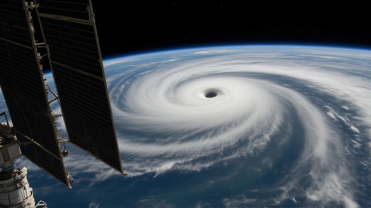
Imagine a river of warm water stretching nearly 9,000 miles across the equator. That’s exactly what scientists are watching right now in the Pacific Ocean. This massive band of heat isn’t just sitting there—it’s moving eastward like a freight train, and it could be the fuel for a powerful El Niño event.
The potential impact is global. We’re talking about everything from heavier rains in California to severe droughts in Australia. But here’s the twist: this isn’t guaranteed. It’s a complex dance between ocean temperatures and atmospheric winds that meteorologists are tracking with intense focus.
The Mechanics of a Climate Superstorm
To understand why this matters, you have to look at the physics. Normally, strong trade winds blow from east to west along the equator. These winds pile up warm surface water in the western Pacific (near Indonesia) and allow cold, nutrient-rich water to rise to the surface in the east (off the coast of South America). This is the baseline state.
But when those winds weaken—or even reverse—the dynamic flips. The warm water sloshes back toward the center and east. Currently, observational data shows a thick layer of water, warmer than average by several degrees Celsius, extending from the Maritime Continent all the way to the coasts of Ecuador and Peru. This is what experts are calling the "freight train" of heat.
Driving this movement are downwelling Kelvin waves. Think of these as planetary-scale ripples that travel along the ocean floor near the equator. When they hit the central Pacific, they push the thermocline (the boundary between warm surface water and cold deep water) deeper. This allows the stored heat to rise closer to the surface, raising sea-surface temperatures significantly.
What Defines a 'Super' El Niño?
You’ve likely heard the term "super El Niño" in the news. It’s catchy, but it’s not an official scientific category. Scientists prefer precise terms like "strong" or "very strong." However, media outlets use "super" to describe events that rival the historic benchmarks of 1982–1983, 1997–1998, and 2015–2016.
National Oceanic and Atmospheric Administration (NOAA) defines an El Niño event based on sustained positive sea-surface temperature anomalies in the Niño-3.4 region of the central Pacific. Specifically, if temperatures stay at least +0.5°C above the long-term average for five overlapping three-month periods, we officially declare El Niño conditions.
The current anomaly readings are concerning. In some zones, temperatures are running +1°C to +3°C above average. If these numbers hold steady and the atmospheric coupling strengthens, we could see an event comparable to the 1997–1998 phenomenon, which caused billions in damages worldwide.
Global Ripple Effects
Why should you care if the Pacific gets warmer? Because the tropical Pacific acts as a thermostat for the entire planet. When it heats up, it releases massive amounts of energy into the atmosphere, altering jet streams and weather patterns globally.
Here’s what history tells us to expect:
- Southern United States: Typically wetter-than-average winters, increasing flood risks in places like Texas and Florida.
- Australia and Southeast Asia: Often face hotter, drier conditions, exacerbating wildfire risks and agricultural stress.
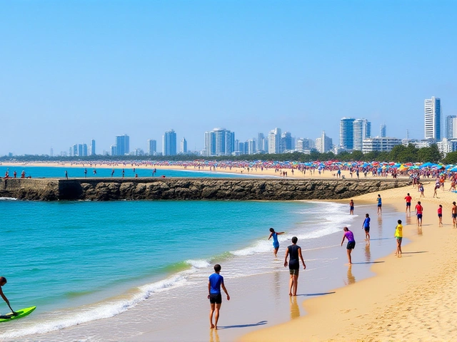
- South America: Coastal regions may see heavy rainfall and landslides, while northern areas could experience drought.
- Hurricane Activity: El Niño usually suppresses Atlantic hurricanes due to increased wind shear but can boost cyclone activity in the central and eastern Pacific.
Moreover, in a world already warmed by greenhouse gas emissions, a strong El Niño can push global average temperatures to new record highs. The 2015–2016 event helped set temperature records that still linger in public memory.
Forecasting Uncertainty
Despite the alarming imagery of a "freight train," climate forecasting remains probabilistic, not deterministic. Models from Copernicus Climate Change Service and other international partners show elevated odds—often above 60% to 70%—for El Niño developing in upcoming seasons. But probabilities aren’t guarantees.
The atmosphere can behave unpredictably. Sometimes, despite warm ocean waters, the winds don’t cooperate, and the event fizzles out. Other times, feedback loops intensify the warming rapidly. Experts emphasize that decision-makers should plan for a range of scenarios rather than betting on a single outcome.
Monitoring the Situation
Scientists rely on a sophisticated network to track these changes. This includes the TAO/TRITON moored buoy array in the Pacific, satellite altimeters measuring sea-surface height, and Argo floats profiling subsurface temperatures. Data from these sources feeds into coupled ocean-atmosphere models used by agencies like the National Weather Service Climate Prediction Center.
Over the coming months, updated ENSO outlooks will refine our understanding. Will the warm water pool persist? Will the trade winds continue to weaken? The answers will determine whether we face a moderate shift or a full-blown climate superstorm.
Frequently Asked Questions
What is the 'freight train' of warm water?
It is a metaphorical description used by scientists to explain a continuous band of anomalously warm water stretching approximately 9,000 miles across the equatorial Pacific Ocean. This heat is being transported eastward by weakened trade winds and Kelvin waves, potentially fueling an El Niño event.
How does El Niño affect weather in the US?
El Niño typically brings wetter and cooler conditions to the southern United States, including California, Texas, and Florida, increasing flood risks. Conversely, the northern tier of the US often experiences warmer and drier winters. It also tends to suppress hurricane activity in the Atlantic Ocean.
Is a 'super El Niño' scientifically defined?
No, 'super El Niño' is a media term, not an official scientific classification. Meteorologists use categories like weak, moderate, strong, and very strong based on sea-surface temperature anomalies in specific Pacific regions. A 'super' event generally refers to one comparable in strength to the historic 1997–1998 or 2015–2016 episodes.
When will we know if a strong El Niño develops?
Climate agencies like NOAA issue monthly ENSO outlooks. While current indicators point toward El Niño conditions, the final strength depends on how the ocean and atmosphere interact over the next few months. Forecasts become more reliable as the event progresses, with key updates expected through the fall and winter seasons.